Trails
Join the Perryville Greenway Committee.
The Perryville Greenway Committee is committed to creating new trails, partnering with other trail organizations and encouraging people to get outdoors, enjoy the natural setting and get exercise.
Our Committee meets every-other month at 10am in the Perryville Town Hall Conference Room. Please join us! The next meeting is scheduled for February 20th at 10:00 a.m. - no RSVP needed.
_______________________________________________________
Perryville is a member community of the Lower Susquehanna Heritage Greenway (LSHG). A trail map is available on the LSHG website by clicking here:
Perryville has also partnered with the Mason-Dixon Trail System for M-DT to go through Perryville. To be re-directed to the M-DT Trails website for more information including trail maps, please click here:
Canning House Run Trail
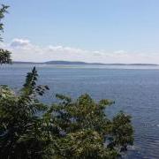
Canning House Run Trail extends from Historic Rodgers Tavern going north approximately .8 miles along Roundhouse Drive in Perryville to the Community Boat Ramp and passing by Ice House Park along the way. Enjoy beautiful water views of the Susquehanna River on your walk or bike ride. This is a paved trail and is an easy walk. Note: there is vehicle parking at both ends of this trail - the Boat Ramp and Rodgers Tavern. When parking at the boat ramp, park in the vehicle spaces next to the Comfort Station.
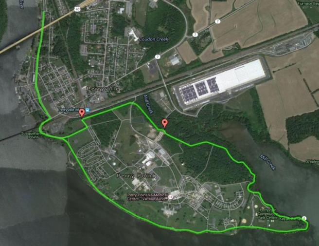
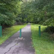
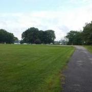
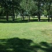
Community Park and VA Loop Trail
PLEASE NOTE: A government issued ID is needed if you use the VA section of the Trail
The main entrance to this trail is at the Perryville Community Park, 100 Marion Tapp Parkway, Perryville, where you will find ample parking. The entire length of the trail is approximately 3.5 miles. This trail has varying surfaces, from natural surface, to paving to sidewalks and gravel. Starting in the park, follow the soft shoulder of the roadway (Interim Route) around the point and back along the entrance road (Interim Route) to the park. Right at the junction of the VA entrance the trail exits the soft shoulder of the road and follows a path that is just north of the VA entrance between the VA entrance and the park exit. From here, the first .3 miles of the trail is natural surface, then it transitions for another .3 miles to a paved surface. From there you cross the VA grounds to Avenue A and walk along sidewalks and trail until returning to the Community Park. Once back in the park, pedestrians can walk along the soft shoulder of the road (Interim Route) around the point and back to where they started. This is a really pretty walk through the woods with lots of opportunities to see wildlife, followed by scenic views of the bay and river as you walk or bike along the waterfront.
Note: Interim route means that vehicular traffic has the right-of-way on the road, so please stay on the soft shoulder. Please bear with us while we work to build separate trails.